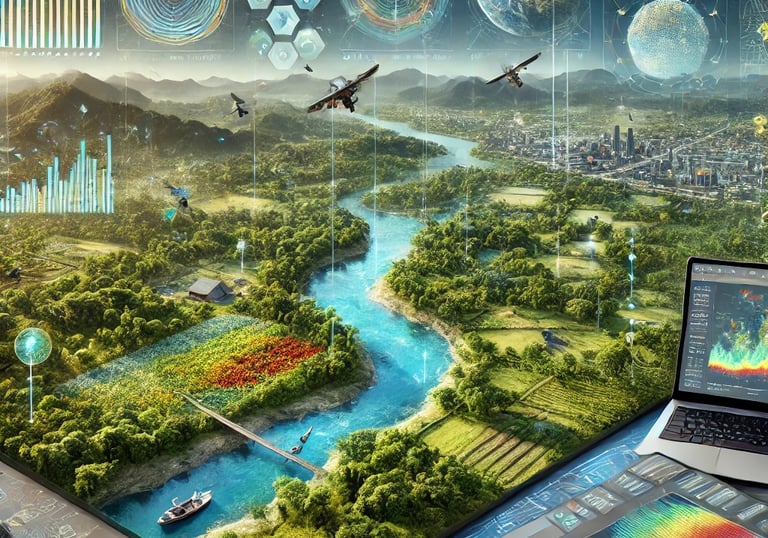
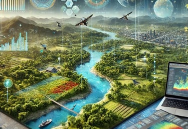
Geospatial Engineering Services
At Geospatial Engineering Pty Ltd, we offer a comprehensive range of geospatial services designed to meet the diverse needs of our clients. Leveraging our extensive experience and advanced technologies, we deliver high-quality solutions across various sectors, including oil and gas, renewable energy, and infrastructure. Here’s a closer look at our key services:
Environmental Management
Expertise in managing environmental resources through advanced geospatial technologies and sustainable practices.
Infrastructure Planning
Comprehensive planning solutions utilizing precision data for effective infrastructure development and management.
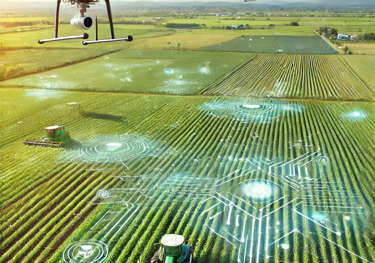
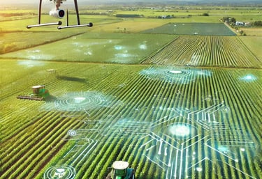
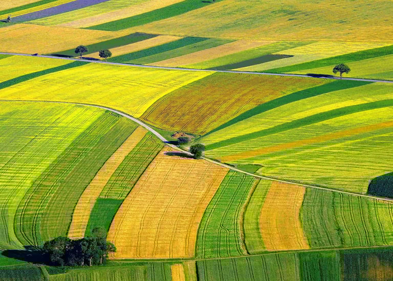
Precision Agriculture Solutions
Agricultural Innovation
Our Services
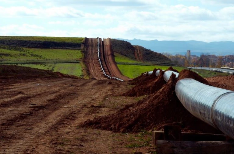
Oil and Gas Sector Inspection
Pipeline Inspection and Monitoring: Utilize remote sensing and drone technology for detailed inspections, detecting issues like leaks and corrosion early. For instance, our drone inspections revealed corrosion in a major pipeline, enabling timely repairs.
Facility Inspection: Conduct thorough inspections of oil and gas facilities using LiDAR for precise measurements, ensuring compliance with safety regulations. Our recent use of LiDAR helped optimize maintenance schedules for a refinery.
Asset Management: Develop comprehensive asset management systems integrating GIS and real-time monitoring, enhancing operational decision-making. We created an asset management system that significantly improved asset reliability for a major company.
Mapping and Surveying for Route Planning
Route Surveying: Perform precise surveys to determine optimal routes for transmission lines and pipelines, minimizing environmental impact. Our route surveying optimized a transmission project by reducing construction costs and environmental disruption.
Topographic Mapping: Produce detailed topographic maps highlighting elevation changes and obstacles. Our topographic maps were crucial for planning a utility network expansion.
Geospatial Analysis: Analyze spatial data to assess route impacts on infrastructure and resources. Our analysis for a pipeline project helped avoid sensitive areas and reduce regulatory delays.
GIS and Remote Sensing for Renewable Energy
Site Assessment: Evaluate sites for renewable energy projects using GIS and remote sensing to identify optimal locations. Our site assessment for a solar farm identified high-yield areas and minimized land conflicts.
Environmental Impact Analysis: Conduct comprehensive assessments to understand potential impacts on ecosystems. Our analysis for a wind farm helped minimize ecological disturbance.
Resource Mapping and Monitoring: Provide detailed mapping of renewable resources to optimize project performance. Our resource mapping for a wind energy project improved turbine placement.
Carbon Project Development
Forest Carbon Sequestration: Monitor forest growth and regeneration for carbon credit certification. Our tracking supported successful certification for a forest carbon sequestration project.
Soil Carbon Projects: Use remote sensing and GIS to monitor soil health and carbon levels. Our data enabled effective carbon sequestration practices for a soil carbon project.
Beef Herd and Vegetation Method: Analyze grazing patterns and pasture health to support livestock carbon projects. Our analysis helped optimize grazing and improve pasture management.
Forest Monitoring and Management
Forest Site Analysis: Conduct site-specific analysis for forest projects, including tree species identification and vegetation mapping. Our analysis supported sustainable forest management practices.
Forest Growth Monitoring: Track growth and regeneration to guide reforestation strategies. Our monitoring provided insights that helped meet project goals.
Carbon Reporting: Generate detailed reports on forest carbon stocks and regeneration for carbon offset programs. Our reports supported certification and demonstrated sustainability.
Geospatial Data and Analysis
Spatial Data Insights: Analyze and evaluate spatial data to support project decisions. Our urban development data analysis streamlined planning processes.
Geospatial Outputs: Create high-quality maps and datasets for various applications, including project assessments and reporting. Our mapping data enhanced environmental reporting for a land monitoring project.
Environmental Project Solutions: Identify and design spatial solutions for environmental projects, ensuring regulatory compliance. Our design for a wetland restoration project improved ecological outcomes.
Road Infrastructure and Asset Management
Road Infrastructure Management: Map road networks, assess conditions, analyze traffic patterns, and support infrastructure planning. Our condition assessments and traffic analysis improved urban roadway management.
Asset Management: Create detailed asset inventories, monitor conditions, integrate real-time data, and manage asset lifecycles. Our solutions optimized asset usage and extended lifespan for public transportation networks.
Water Resources Management
Water Resource Monitoring: Monitor water bodies and quality for effective irrigation and resource management. Our monitoring optimized water usage for a large agricultural project.
Flood Modeling and Risk Assessment: Generate flood models to design control systems and mitigate risks. Our modeling helped design effective flood defenses for a coastal city.
Precision Agriculture
Crop Yield Estimation: Use imagery to estimate yields and optimize planting strategies. Our estimations improved crop productivity for a large-scale farm.
Weed Eradication and Soil Management: Identify weed infestations and monitor soil conditions to enhance crop health. Our tools guided effective management for a vineyard.
Topographical Surveying and 3D Modeling
Topographical Surveys: Create precise topographical maps for site planning and design. Our surveys provided crucial data for urban development projects.
2D and 3D Modeling: Develop detailed models for better visualization and planning. Our models improved design outcomes for a residential development.
Environmental and Ecosystem Management
Vegetation Health Monitoring: Track vegetation changes to support conservation efforts. Our monitoring guided management actions for a conservation project.
Ecosystem Analysis and Conservation: Assess ecosystems to support conservation activities. Our work provided insights for a wetland restoration project.
Aerial and Drone-Based Surveys
High-Resolution Aerial Mapping: Capture detailed spatial data using high-resolution drones. Our mapping provided accurate site analysis for construction projects.
Ultra-High-Resolution Imaging: Conduct in-depth analysis of land and infrastructure with advanced sensors. Our imaging supported major environmental studies.
Additional Services
Environmental Monitoring: Monitor environmental parameters to ensure compliance and manage impacts. Our monitoring helped maintain compliance for an industrial site.
Drone Mapping and Surveying: Use advanced drones for high-resolution surveys. Our surveys provided accurate data for land use planning.
3D Modeling and Visualization: Create detailed 3D models to visualize complex data. Our models facilitated better planning and stakeholder communication for infrastructure projects.
Continuous Improvement
Innovation: Enhance data analysis methods and project insights through continuous improvement. Our improvements led to more accurate environmental impact assessments.
Process Documentation: Maintain thorough documentation and update procedures as needed. Our meticulous documentation ensured consistency in geospatial workflows.
Geospatial Solutions
Transforming industries with advanced geospatial technologies and services.
Innovative strategies for sustainable environmental practices and planning.


GIS and Remote Sensing for Renewable Energy
Precision mapping for efficient and effective infrastructure development.


Agricultural Solutions
Enhancing precision agriculture with cutting-edge geospatial technology.
Water Resources
Optimizing water management through accurate spatial data analysis.
Mapping and Surveying for Route Planning

Geo-Spatial Engineering provided exceptional data that transformed our project outcomes and decision-making process significantly.
John Smith

Their innovative GIS solutions greatly improved our environmental management efforts, delivering precise data and effective strategies.
Emma Brown

★★★★★
★★★★★
Innovation
Transforming industries with advanced geospatial solutions.
Precision
Sustainability
contact@geo-spatial.com.au
© 2024. All rights reserved by Geo-Spatial Engineering.